


Elevate Your Projects with Advanced Drone Mapping Solutions
Drone mapping involves using unmanned aerial vehicles (UAVs) equipped with high-resolution cameras and sensors to capture detailed images and data from above. This technology provides a comprehensive overview of landscapes, structures, and infrastructure, transforming how we approach various projects. By leveraging drones, professionals can access accurate, up-to-date information with remarkable efficiency.
Contents |
[edit] Technology Behind Drone Mapping
Drone mapping technology combines advanced UAVs with sophisticated sensors and cameras. Drones are equipped with high-definition cameras that capture aerial imagery, while GPS systems ensure precise location tracking. These components work together to gather extensive data, which is then processed using specialised software to create detailed maps and 3D models.
[edit] Applications of Drone Mapping
Drone mapping finds applications across multiple sectors:
- Construction and Infrastructure: Drones provide real-time progress updates, monitor site conditions, and support planning and design processes.
- Agriculture and Environmental Monitoring: They offer insights into crop health, land usage, and environmental changes, aiding in better decision-making.
- Urban Planning and Development: Drones assist in analysing city layouts, planning new developments, and managing urban growth.
- Real Estate and Property Management: High-resolution aerial imagery enhances property listings, provides site assessments, and supports marketing efforts.
[edit] Advantages of Drone Mapping
The use of drones for mapping offers several advantages:
- High-Resolution Imagery: Drones capture detailed and clear images, allowing for accurate analysis and decision-making.
- Efficiency and Cost-Effectiveness: Drones cover large areas quickly, reducing the need for extensive ground surveys and saving time and money.
- Enhanced Data Accuracy and Precision: The integration of GPS and other sensors ensures precise data collection and mapping.
- Access to Difficult or Dangerous Areas: Drones can reach areas that are challenging or hazardous for human access, providing valuable data without risk.
[edit] Choosing the Right Drone Mapping Service
When selecting a drone mapping service, consider:
- Service Provider Expertise: Ensure the provider has experience and expertise in handling projects similar to yours.
- Equipment Quality: Check the quality of the drones and technology used to ensure accurate and reliable results.
- Project Needs: Assess your specific requirements and choose a service that can cater to those needs effectively.
[edit] Case Studies and Success Stories
Numerous projects have benefited from drone mapping:
- Construction: A large infrastructure project used drones to monitor progress and manage logistics, leading to improved efficiency and cost savings.
- Agriculture: Farmers utilised drones to monitor crop health and optimise resource use, resulting in increased yields and reduced waste.
[edit] Conclusion
Drone mapping services offer innovative solutions for capturing detailed, accurate data across various sectors. As technology advances, drone mapping will continue to enhance project planning and execution. To leverage these benefits, consider incorporating drone mapping into your projects and stay ahead of the curve in your industry.
Featured articles and news
Cyber Security in the Built Environment

Protecting projects, data, and digital assets: CIOB Academy.
The UK's campaign to reduce noise pollution: Mythbusting, articles and topic guides.
Setting Expectations on Competence Management
Industry Competence Committee.
New Scottish and Welsh governments

CIOB stresses importance of construction after new parliament elections.
The sad story of Derby Hippodrome
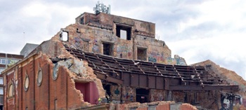
An historic building left to decay.

ECA, JIB and JTL back Fabian Society call to invest in skills for a stronger built environment workforce.

Women's Contributions to the Built Environment.
Calls for the delayed Circular Economy Strategy

Over 50 leading businesses, trade associations and professional bodies, including CIAT, and UKGBC sign open letter.
The future workforce: culture change and skill

Under the spotlight at UK Construction Week London.

A landmark moment for postmodern heritage.
A safe energy transition – ECA launches a new Charter
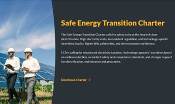
Practical policy actions to speed up low carbon adoption while maintaining installation safety and competency.
Frank Duffy: Researcher and Practitioner

Reflections on achievements and relevance to the wider research and practice communities.
The 2026 Compliance Landscape: Fire doors
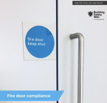
Why 'Business as Usual' is a Liability.
Cutting construction carbon footprint by caring for soil

Is construction neglecting one of the planet’s most powerful carbon stores and one of our greatest natural climate allies.
ARCHITECTURE: How's it progressing?
Archiblogger posing questions of a historical and contextual nature.